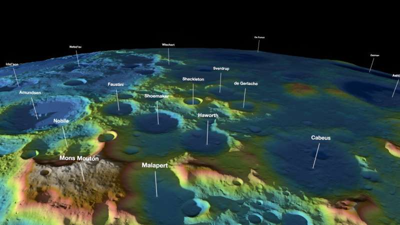
Lunar Reconnaissance Orbiter’s Lunar Orbiting Laser Altimeter has produced detailed maps of the Lunar South Pole, including where water ice appears to fill the bottoms of permanently shadowed craters. Similar to sonar, but using light instead of sound, lidars calculate distances by timing how long a laser beam takes to reflect off a surface and return to an instrument. They increasingly help NASA scientists and explorers navigate, map, and collect scientific data.
#SCIENCE #Urdu #GH
Read more at Phys.org
